Class: IV/V
Quality: 4 (The run would be a 5 besides for the access issues)
Location: Stikine Region, Northwest BC, Canada
Trip Time: 1-2 days (60 km)
Level: 200cms + on Stikine Gauge
Put-in: 57°26’48.3″N 130°16’12.9″W
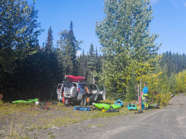
The put – in is easy, if you’re heading north on the Dease Lake Highway it’ll be a left turn on a logging road called Willow Creek. It’s only about 2 kilometers from here down to the river. There is a pull off right before a bridge and, when we did the run, there were no gates between this put-in and the highway so no chance of being locked out or worse locked in.
Take-out: 56°56’31.1″N 130°21’15.7″W
The Take-out is the difficult part of this run. All the roads down the the river below the whitewater were gated off so we had to hike out. I’m not sure if there’s someone that knows how to access those areas or if everyone has to hike out. We found two hike options one was to hike 2 km up the Ningunsaw River and then up a steep bramble covered hill to a cut block. This was definitely the better option but I didn’t want to tear my drysuit so I opted for a 12 km hike up the Ningunsaw all the way back to the Dease Lake Highway.
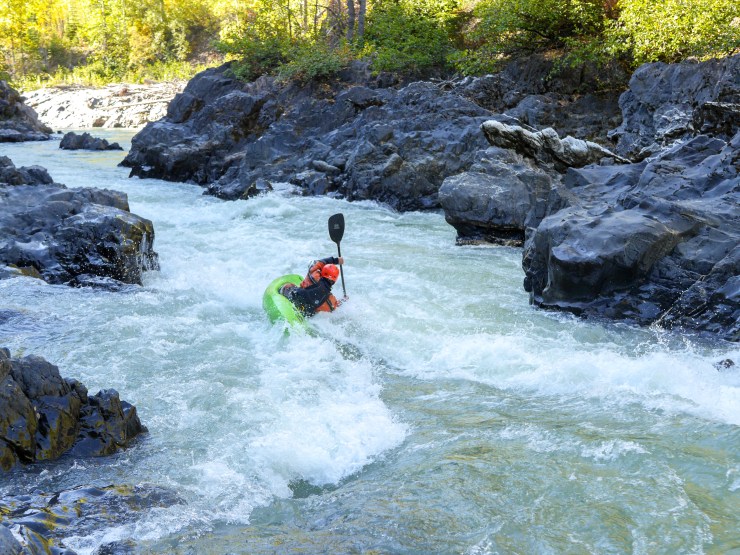
The run starts off pretty slow, meandering through about 15 km of flat water and boogie. The whitewater slowly starts to build with a few class III/IV rapids in some interesting canyons. We saw a big black bear fishing in the first rapid so keep your eyes peeled for wildlife. The rapids continue to build as the river canyon gets deeper. After about 5 km of sporadic class III/IV drops you’ll begin to get into some harder rapids.
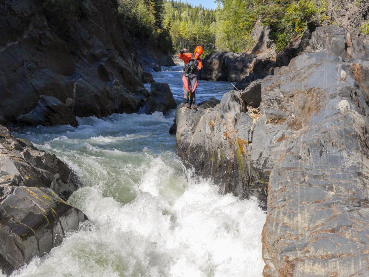
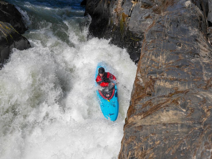
The gradient stays pretty steep for about 20 km. We only scouted a few rapids and were able to run most of them by eddy hopping but we also had low water when we did this run. Most of the rapids were long boulder gardens but one of the rapids early on stood out. We all scouted this one on river left. Only one person managed to run it cleanly. The rapids seemed to go on forever with sections of easy whitewater mixed in.
As it got later in the day the rapids started to get easier and eventually turned back into flat water. About 2 km after the last notable boulder garden we arrived at the hot springs and set up camp. We camped on a gravel bar that wouldn’t have been above water if the level was much higher but there are probably other camping spots in the trees around the springs. The next day we just had 10 or 15 km of flat water down to the confluence with the Ningunsaw and the terrible hike out.
